CIV250 · Hydraulics and Hydrology
Bear Creek
Reconstructing the August 2023 flood in an Ontario watershed.
Bear Creek is the North Branch of the Sydenham River in Lambton County, southwestern Ontario. In a four-person group for CIV250 (Hydraulics and Hydrology), we built a rainfall-runoff model of the watershed in HEC-HMS and tested whether it could reproduce what the gauges actually recorded during a real storm.
As Modelling Lead I built the HEC-HMS model and ran the calibration. The first run under-predicted the flood peak of the storm on 24–25 August, while flows before the storm were too high. The initial parameters missed the flood peak, the number that matters most, and only comparing the output against real gauge data showed where the model was wrong.
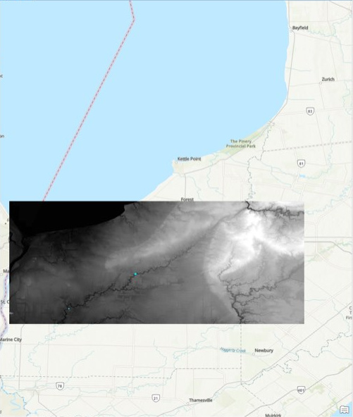
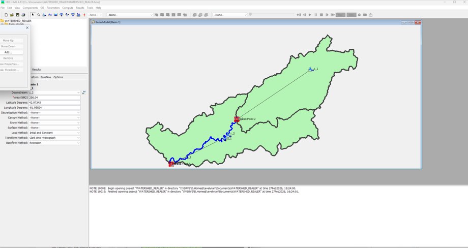
Drawing the watershed
The team’s model followed the drainage area upstream of Water Survey of Canada gauges at Petrolia and Brigden. Delineating this area from elevation data determined which rainfall contributed to river flow at each gauge.
Calibrating against the flood peak
NASA precipitation and temperature data drove the simulation from 1 August to 1 September 2023. The initial model let too much storm rainfall soak in. Raising the runoff curve number lifted the simulated peak. Reducing initial baseflow from 3 to 0.5 m³/s lowered simulated flow before the storm.
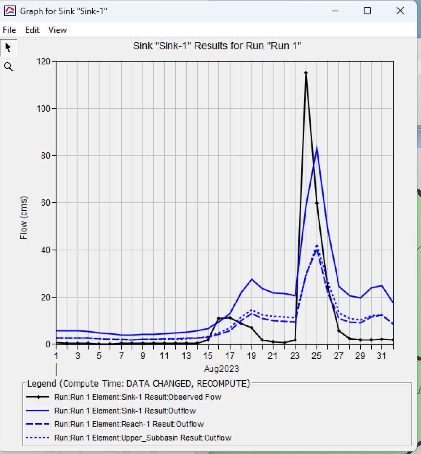
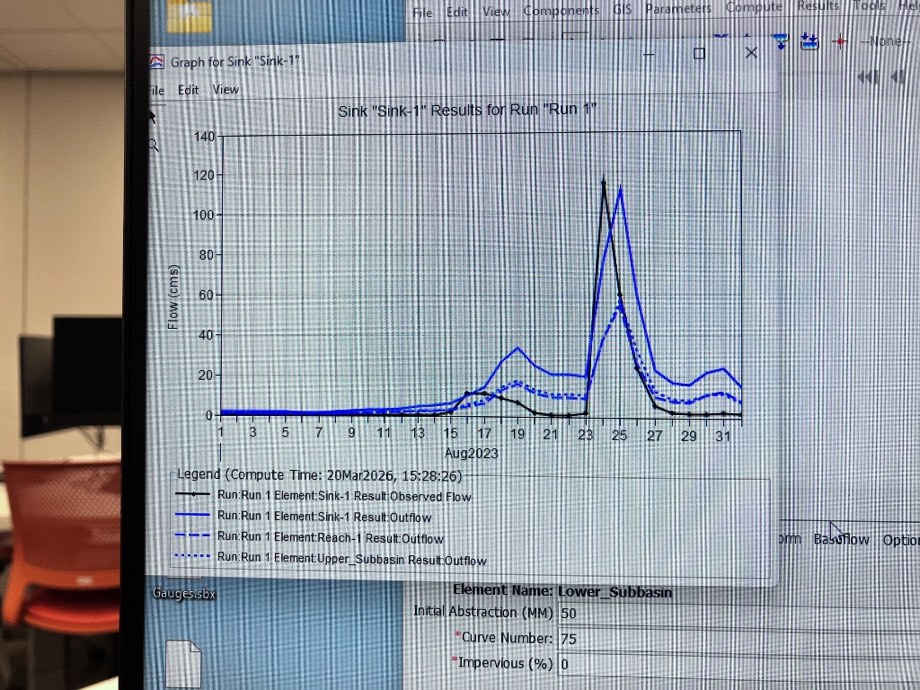
The initial run underestimated the observed peak by about 30 m³/s. After calibration, the simulated peak was close to the observed 115 m³/s and arrived about one day later. In both plots, black shows observed flow and solid blue shows modelled outlet flow. The vertical scales differ.